Directions
From Oakland International Airport
- Start out going west on Airport Dr toward Alan Shepard Way. (go 0.25 miles)
- Turn right onto Alan Shepard Way. (go 0.05 miles)
- If you reach 2 you’ve gone a little too far
- Take the 1st right onto John Glenn Dr. (go 0.54 miles)
- If you reach the end of Alan Shepard Way you’ve gone about 0.3 miles too far
- Turn right onto Ron Cowan Pky. (go 0.04 miles)
- Turn left onto ramp. (go 0.24 miles)
- Merge onto Airport Dr. (go 0.44 miles)
- Airport Dr becomes Airport Access Rd. (go 0.32 miles)
- Turn slight right onto Hegenberger Rd. (go 0.82 miles)
- Hegenberger Rd is 0.1 miles past 98th Ave.
- Merge onto I-880 N. (go 9.43 miles)
- I-880 N becomes I-80 E. (go 4.45 miles)
- Take I-580 W toward Point Richmond/San Rafael (Portions toll). (go 13.48 miles)
- Merge onto US-101 N. (go 53.45 miles)
- Take the Dry Creek Road exit. (go 0.28 miles)
- Turn left onto Dry Creek Rd. (go 6.18 miles)
- If you reach US-101 N you’ve gone about 0.2 miles too far
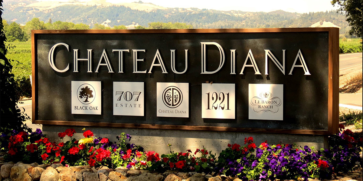
6195 DRY CREEK RD is on the left.
- Your destination is 0.6 miles past Bay Laurel Ln
If you reach Canyon Rd you’ve gone about 0.8 miles too far
From San Francisco International Airport
- Start out going east toward T-1 Turnaround. (go 0.12 miles)
- Turn slight left. (go 0.19 miles)
- Merge onto US-101 N toward San Francisco. (go 1.1 miles)
- Merge onto I-380 W via EXIT 423B toward I-280/San Bruno. (go 1.92 miles)
- Merge onto I-280 N via EXIT 5A toward San Francisco. (go 5.95 miles
- Keep left to take CA-1 N via EXIT 49B toward 19th Avenue/Golden Gate Bridge. (go 1.12 miles)
- Turn slight left onto 19th Ave/CA-1 N. Continue to follow CA-1 N. (go 6.29 miles)
- CA-1 N is 0.4 miles past Palmetto Ave
- Temple United Methodist Church is on the corner
- Merge onto US-101 N toward Golden Gate Br. (go 65.96 miles)
- Take the Dry Creek Road exit. (go 0.28 miles)
- Turn left onto Dry Creek Rd. (go 6.18 miles)
- If you reach US-101 N you’ve gone about 0.2 miles too far
- 6195 DRY CREEK RD is on the left.
- Your destination is 0.6 miles past Bay Laurel Ln
- If you reach Canyon Rd you’ve gone about 0.8 miles too far
From Sacramento International Airport
- Start out going east on Airport Blvd. (go 0.04 miles)
- Enter next roundabout and take the 1st exit onto Earhart Dr. (go 0.37 miles)
- Stay straight to go onto Airport Exit. (go 0.49 miles)
- Turn slight left onto Airport Blvd. (go 0.56 miles)
- Merge onto I-5 N toward Redding. (go 8.26 miles)
- Merge onto E Main St via EXIT 537 toward CA-113 S/Woodland. (go 0.71 miles)
- Merge onto CA-113 S via the ramp on the left toward Davis. (go 11.12 miles)
- If you reach Matmor Rd you’ve gone about 0.1 miles too far
- Merge onto I-80 W. (go 30.23 miles)
- Merge onto Jameson Canyon Rd/CA-12 toward Napa/Sonoma. (go 6.32 miles)
- Turn right onto CA-29 N/CA-12 W. (go 3.96 miles)
- CA-29 N is 0.2 miles past N Kelly Rd
- Turn left onto CA-12/CA-121. (go 8.23 miles)
- Turn slight left onto CA-121. (go 1.08 miles)
- CA-121 is 0.3 miles past 8th St E
- Turn right onto CA-116. (go 4.87 miles)
- CA-116 is 0.2 miles past Maffei Rd
- Turn left onto Stage Gulch Rd/CA-116. (go 2.29 miles)
- Stage Gulch Rd is 0.8 miles past Willie Bird Way
- If you are on Adobe Rd and reach Soldat Rd you’ve gone about 0.5 miles too far
- Turn right onto Lakeville Hwy/CA-116 W. (go 4.18 miles)
- Lakeville Garage is on the corner
- Merge onto US-101 N toward Eureka. (go 32.48 miles)
- If you are on Lakeville St and reach Caulfield Ln you’ve gone about 0.3 miles too far.
- Take the Dry Creek Road exit. (go 0.28 miles)
- Turn left onto Dry Creek Rd. (go 6.18 miles)
- If you reach US-101 N you’ve gone about 0.2 miles too far
- 6195 DRY CREEK RD is on the left.
- Your destination is 0.6 miles past Bay Laurel Ln
- If you reach Canyon Rd you’ve gone about 0.8 miles too far